- Main
- Table of Contents
- Lesson Sample
- System Requirements
GIS in Economic Development
Overview
Request Information
Order From Digital Quest
Course Info:
Hours:
Approximately 90
Software Included:
ArcGIS Desktop - ArcView
Deliverables:
Lauderdale County Demo Data
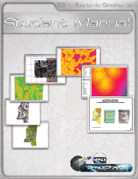
Student Manual
Lesson Plans
PowerPoint Presentation
PowerPoint Notes
Assessments
Optional:
Customized Local Data Set
Teacher Training:
3 Days

The use of Geographic Information Systems (GIS) empowers economic developers to view and analyze pertinent information critical to the growth and development of a community or region. Many factors contribute to the economic and overall well being of a community. Data that tracks such regional dynamics provide indicators of the level of quality of life and economic viability of a region.
GIS enables the visualization and study of these community factors through the use of maps and spatial analysis techniques. Plotting maps that show where a specific set of geographic conditions exist empowers economic developers to hone in on specific sites within a community that embody all of the right criteria for specific types of development. By studying the various geographic elements in a community through the use of maps and spatial analysis, an economic developer may harness a new understanding of the economic dynamics of the community. Exploring opportunities for new investments and strengthening existing business and industry are tasks that are enhanced through the study of geospatial information.
This demonstration project uses geospatial data from Lauderdale County, Mississippi and addresses the mission of the East Mississippi Development Corporation to empower a diverse leadership culture to achieve economic wealth through excellence in education, new investment, and the nurturing of existing business industry. Your students will focus on three main processes:
Table of Contents
Lesson Sample
System Requirements
Based on latest version of ArcGIS Desktop supported in the most recent course update


