- Main
- Table of Contents
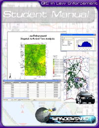
- Lesson Sample
- System Requirements
GIS in Law Enforcement
Share With Others:


Overview
Request Information
Order From Digital Quest
Course Info:
Hours:
Approximately 90
Software Included:
ArcGIS Desktop - ArcView
Deliverables:
Medford County Demo Data
Student Manual
Lesson Plans
PowerPoint Presentation
PowerPoint Notes
Assessments
Teacher Training:
3 Days
“Police Departments have long maintained databases with information on
crimes, suspects, arrestees, motor vehicle, and calls for service. These
databases are seldom put to the proper use that the should. Move into the age of Intelligence Led Policing. Unlock the power of the dormant static police data warehouse! Learn how to conduct strategic and tactical analysis to focus your limited resources for effective community policing. This 21st Century
Technology is one of the most poweful tools you can give to your police agency the wave of the future of Law Enforcement.” - Chief Edwin Wood, Former Police Chief, Medford Township
The paradigm of large scale disaster management has changed. Geographic Information Systems (GIS) have become an integral part in that change in predicting and responding to a variety of scenarios, but GIS is not intended for large scale management only. Crime and Calls for Service exist on the state, regional, and local levels, and the use of Geographic Information Systems (GIS) empowers law enforcers to view and analyze pertinent information critical to the safety and well being of a community or region. Geospatial data relevant to law enforcement and crime analysis are: political and administrative boundaries, natural and manmade landscape features, population demographics, policing features, and calls for service (CFS) locations.
GIS enables the visualization and study of these geospatial factors through the use of maps and spatial analysis techniques. By geographically coding the locations of Calls for Service (CFS), each incident can be plotted on a map to show it’s location within a community. This is not unlike the pin-mapping on paper maps that many police departments have been doing for decades. This enhanced technology enables law enforcers to further apply spatial analysis techniques to the distribution of CFS points to determine consistent patterns in the incidents. This enables a better proactive strategic allocation and deployment of personnel to regularly ensure the greatest possible protection.
The “GIS for Law Enforcement” Course allows you to answer these types of questions by teaching you to analyze and visualize the pertinent data. The course uses a variety of datasets and the capabilities of ESRI’s ArcGIS to answer questions relating to tracking perpetrators, locating drug trafficking, and determining motor vehicle accident hotspots.
Table of Contents
Lesson Sample
System Requirements
Based on latest version of ArcGIS Desktop supported in the most recent course update