
SPACE Curriculum
Teacher Materials:
Lesson Overviews
Each lesson in the teacher’s edition comes with a lesson overview page for instructors with boxes in the margins that provide quick reference to lesson goals. The overview describes in detail the skills taught in the lesson as well as additional information that may be necessary to complete the lesson. Lesson related links for further study are also supplied with each overview page.
Presentation Notes

Each student lesson comes with a PowerPoint presentation that provides an overview of the lesson including concepts, the skills covered, and the study area involved. The teacher’s manual is supplemented with detailed descriptions and commentary for each slide allowing a diverse range of instructors to lead classroom lecture.
Assessments
Lessons will conclude with a full page color layout of a successfully completed exercise. If questions are presented within a lesson, the teacher’s manual includes answers to those questions.
Overview
The SPACE series of courses are designed to allow students to use GIS skills in the context of selected community based topics. This series fits a variety of needs in an organization. Whether, your organization is made of students looking for introductory to intermediate training or in need of continuing education, SPACE courses can provide a solid foundation on which to build.
As GIS evolves it becomes more evident how GIS can help specific sectors of the economy. The SPACE series describes and teaches GIS through the eyes of organizations who have a vested interest in the community. These organizations are the businesses and government agencies that protect us and increase the efficiency of our everyday lives.
The SPACE Series currently offers four different scenarios with new titles debuting annually. Use GIS to efficiently develop industry and define regional indicators in our GIS in Economic Development course. Experience how Homeland Security uses GIS to plan and ensure effective planning in natural and human driven events that may effect the security of our nation in our GIS in Homeland Security Course. See how GIS is being used to redefine the way our Law Enforcement agencies track criminals, predict crime, and manage the day to day workings of these agencies in our GIS in Law Enforcement Course. Or see how a county government works to control disease and the insect population in ou GIS in Mosquito Control course.
These courses teach not only "Buttonology" but also process in efforts to prepare our students and workers to be effective technically and organizationally in their respective areas. As with all of the SPACESTARS products this series is delivered with Powerpoints, Lesson Plans, and Assessments to make sure that teachers and students have all of the tools they need to successfuly complete a class.
Becoming Certified
Certification is a prominent feature of our STARS series. Learn how you can integrate our SPACE course to gain SPACE certification that combines skills and recognition of a topic focus. Turn learn more about SPACE Certification: Click Here!
Features in This Series
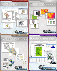
SPACE Titles
Click on a title to see more information. Use the scrollbar at the bottom to see all SPACE titles. To review all available Digital Quest titles visit the "Book Viewer": Click Here!
GIS in Economic Development Site selection techniques are used in business, economic development, and many other fields. This book guides you through step by step data, software tools, and strategy to find a site for a warehousing facility, applying geospatial tools and thinking. The three stages featured are: regional indicators, site suitability, and site selection. |
GIS in Homeland Security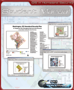 This Homeland Security in GIS course addresses the compilation, management, and analysis of the many different types of critical geographic elements in our communites. It applies to a range of GIS methods to the preparation and implementation of the five phases of Homeland Security strategic planning. |
GIS in Law Enforcement Move into the age of Intelligence Led Policing. Unlock the power of the dormant static police data warehouse!A database is only as good as the question you ask it. GIS is the tool to ask all the hard questions and get answers. Learn how to conduct strategic and tactical analysis to focus your limited resources for effective community policing. |
GIS in Mosquito Control |
Follow Us On:
 |
Share With Others:
|
Share With Others:


