
Press Releases
Penta Career Students Focus on GIS Curriculum & Using Skills for Community Projects
FOR IMMEDIATE RELEASE: November 13, 2012
Contact: Austin Smith, austins@digitalquest.com, 1.877.573.6683
Share With Others:


Perrysburg, OH – Building on four years of commitment to GIS in the classroom, Penta Career Center has begun its fifth year and it looks to be brighter than ever. A tour of Penta’s Instructor, Dan Wyandt’s classroom, is evidence enough of the amount of enthusiasm GIS has generated among the students. The walls are covered in posters created by past students showing GIS projects with large headers above them with titles such as Government, Geomorphology, Law Enforcement, History, and Health. "Part of my intention is letting new students and students who are touring the school see the different types of work they can do with this technology," said Wyandt. He stresses the essential idea that GIS goes beyond mapping. It is cross curricular and spans multiple real world applications. To introduce younger students to his geospatial program, he wants to start a GIS club for junior high and ninth grade students.
The cross curricular aspect of GIS has been very appealing to the students. Once students learn the basic skills and processes, they successfully apply that knowledge in multiple areas of instruction. Wyandt says, "I've had a student use GIS for a project in his government class displaying different aspects of the Cuban Missile Crisis. Another one used the software to recreate the 911 scenario in New York. For his history class, another student created time frame maps of the Revolutionary War".
When you couple Penta’s use of Digital Quest’s STARS Curriculum with the school’s instructor having such an infectious enthusiasm to develop creative students and a future workforce, the work will likely have a lasting impact on the industry. Students really enjoy the "hands on" part of the curriculum and the bonus of being able to use the software and their skills to analyze and solve real world issues.
Wyandt's students learn the value of using their geospatial skills, not just within the perimeter of the school, but also within their community. Over the duration of the course, Dan's students have worked with agencies and groups within the community on diverse projects. “We have created digital inventories of street and road signs, identified possible problems with runoff water in the Maumee River Watershed, created a digital asset management for a housing facility, and used topographic maps to identify potential "sponge" areas to deter flooding for the Blanchard River Watershed Consortium," Wyandt adds. "We hope to work with a local law enforcement agency this year."
Students and staff also work to raise awareness of the benefits of geospatial technology and connect education with industry. Each year, Penta hosts a Geospatial Technology Conference with their students and those from schools throughout Ohio - from elementary schools to universities. The conference provides a great opportunity to network with colleagues and participate in competitions displaying their geospatial projects. Wyandt's students swept first through third place this year in the high school division. They have local geospatial guests from Wyandt's GIS advisory council come in and judge the projects. Typically, one of the guests will be an astronaut from NASA's nearby Glenn Research Center. These professionals know firsthand how important effective geospatial skills are and also have a keen understanding of the need for a well-prepared workforce.
Wyandt's students also have the opportunity to participate in the City of Toledo's GIS Day for prizes. His students won first through third places at this competition. Prizes for those students ranged from cash prizes to a round of golf.
Several of Penta students have been able to obtain internships. "I've had three students work in the City of Bowling Green in the engineering office, two students work in Lucas County Auditor's office, and one student who was a paid intern in the Lucas County Emergency Management Service helping them set up their 911 GIS Program. Two of my students are returning this semester knowing that they have internships waiting for them in the Spring,” Wyandt said. Several students are also continuing their geospatial studies in post secondary institutions with students studying GIS at Ohio State University, Columbus State, Rhodes State, Central Piedmont, and Bowling Green State University.
The students are not the only ones that have received notoriety for their accomplishments. This past school year, Dan Wyandt was invited to speak at the ESRI User Conference in San Diego, California. This is a privilege that only a few educators are selected for each year.
"It is great to hear that Digital Quest's geospatial curriculum coupled with the instructor's skills and enthusiasm can create such enormous opportunities for students," said Digital Quest President Eddie Hanebuth. "Penta's motto is 'Touching lives - building futures'. Dan is certainly doing that both inside and outside of his classroom."
To learn more about Digital Quest or their products in this and other career focuses, call 1-877- 5REMOTE (1-877-573-6683) , email salesusers@digitalquest.com, or visit . President of Digital Quest, Eddie Hanebuth, twitters as GISGuy.
# # #
Digital Quest, Inc. is a Mississippi-based development and training oriented company with a primary focus of enabling educational institutions to provide skill training in the new and ever-more vital field of Geospatial Technology. Digital Quest is an active member of the EIGS geospatial technology cluster of the Magnolia Business Alliance (MBA). MBA's goal is to impact economic development by serving as an advocate for small and medium sized businesses. Digital Quest is headquartered in Ridgeland, Mississippi and is a member of the Center for Geospatial Excellence at the John C Stennis Space Center. For more information about Digital Quest, visit www.digitalquest.com or contact Eddie Hanebuth at 1877-573-6683, eddieh@digitalquest.com.
Back to Top
Houston Students Using GIS to Impact Community
For Immediate Release: August 21, 2012
Contact: Eddie Hanebuth, (601-856-2237), eddieh@digitalquest.com
Share With Others:
HOUSTON, TX: The High School for Law Enforcement and Criminal Justice (HSLECJ) is now back in session and learning concepts that few other schools across the country offer their students. Recently named in the top 10 percentile of high schools in Houston’s Independent School District, the school has invested in creating outstanding Law and Criminal Justice thinkers. One of their programs making a positive impact in the classroom and the community focuses on geospatial technologies. They offer a class dedicated to geospatial technologies using Digital Quest’s GIS in Homeland Security Community course.
Students begin the year learning the basic concepts behind geospatial technology and project management in the context of Homeland Security. By the end of the course, they apply their knowledge to real-world issues and come up with solutions that can be applied in everyday life. Considering crime in the aftermath of Hurricane Katrina, students researched the problem and showed not only a correlation to area crime rates and displaced Hurricane Katrina populations, but also identified specific locations that were affected. "The kids came up with this study because it was something that they were seeing and they were anxious to know if they could use their geospatial skills to show if this influx was true, if it was a problem, and more," said teacher, Valgene Holmes.
One of the key advantages for students using geospatial technology and the GIS in Homeland Security curriculum is the added value of learning to identify, define, and research a problem. HSLECJ students, in a separate study, hypothesized that existing parole terms for sex offenders were being observed, but due to their studies also recognized that the evidence must be presented visually. They used geospatial technology to answer the spatial question: Are registered sex offenders residing unacceptably close to schools? They found 43 individual violators of these regulations. Ultimately, the students contributed to the arrest of these 43 by providing crucial information.
Students also have focused on cross-curricular topics and given back to the City of Houston. In one such project, students mapped the paths that civil rights leader and politician, Barbara Jordan followed while living in the Houston area. Historical maps featured past residences, schools, jobs and more painting a picture of the influential community member’s impact. Putting in extra time on the weekends, students identified and mapped unnamed cemetery plots in Potters Field giving a voice to some of Houston’s forgotten history.
A key to success has been their teacher and most ardent supporter, Valgene Holmes. Holmes said that when the course was initially purchased by the school, it was given to the geography department. Realizing the value it could bring to his program, Holmes is happy that he was able to take the course into his area of specialty, criminal justice. By doing so, Holmes has demonstrated that it is this type of cross curricular application that really unlocks geospatial potential in curriculum and student success. Furthermore, it enriches student knowledge of related “core” skills like reading and writing. "Kids really like this course because it is hands on. What they don't realize is that while they are working through this curriculum, they are using a technical manual, and following instructions so they are working on their reading and interpretation skills at the same time,” said Holmes.
What makes the program truly unique is that the students seek out relevant community issues and tackle them with enthusiasm and intelligence. The program encourages the students to recognize what they have accomplished and what they can achieve moving forward. Each student is required to maintain a portfolio of the written reports and project documentation completed throughout the course along with resumes, so that they have a body of work on which to reflect and promote in future endeavors. This goes to the heart of many current education trends that aim to improve writing and comprehension standards in all aspects of education.
Holmes also places a premium on his relationship with Digital Quest and the GIS in Homeland Security course whose goals align. Holmes commented, “The way the books are structured, they read about how and why to do something and later on the skill is revisited with fewer instructions, but by that time they already know how to use it so it cements not only the tool but the concept on why and how to use it in their heads.” Holmes sees the value that this curriculum could bring to many different programs - not just criminal justice - and wishes that more schools had it. "I believe that we are the only school in HISD who has the Digital Quest curriculum and I'm not sure why. It is such a solid geospatial curriculum that lends itself to be cross curricular" said Holmes.
Digital Quest is pleased with Holmes and his students’ successes. Digital Quest president Eddie Hanebuth offered, “Holmes has had great success inspiring students and promoting the value of geospatial technology and getting them to not only work through the curriculum, but to embrace their potential and to solve problems outside of school." Hanebuth added, "It’s a special instructor that not only follows course designs, but also takes the time to ensure students are aware of what they have accomplished and what their full potential is. We all gain from that kind of effort."
And how are HSLECJ students performing outside of the program? In University of Houston’s GIS competition, HSLECJ took first place five years in a row. Students have earned degrees directly related to GIS, secured co-op jobs while in high school, and gone on to immediate careers and internships with 911 and emergency operation centers. As long as he is able to continue using the Digital Quest curriculum, Holmes sees this as a trend that will continue.
To learn more about Digital Quest or their products in this and other career focuses, call 1-877- 5REMOTE (1-877-573-6683) , email salesusers@digitalquest.com, or visit . President of Digital Quest, Eddie Hanebuth, twitters as GISGuy.
# # #
Digital Quest, Inc. is a Mississippi-based development and training oriented company with a primary focus of enabling educational institutions to provide skill training in the new and ever-more vital field of Geospatial Technology. Digital Quest is an active member of the EIGS geospatial technology cluster of the Magnolia Business Alliance (MBA). MBA's goal is to impact economic development by serving as an advocate for small and medium sized businesses. Digital Quest is headquartered in Ridgeland, Mississippi and is a member of the Center for Geospatial Excellence at the John C Stennis Space Center. For more information about Digital Quest, visit www.digitalquest.com or contact Eddie Hanebuth at 1877-573-6683, eddieh@digitalquest.com.
Back to Top
Enterprise for Innovative Geospatial Solutions (EIGS) Announces Successful Partnership with Digital Quest- Resulting in approved Geospatial Certifications for the State of Florida
Source: Enterprise for Innovative Geospatial Solutions
For Immediate Release: March 19, 2012
Contact: Tom Koger, 228.295.7117, TKoger@magnolia-ba.biz
Share With Others:
Stennis Space Center, MS -- The Enterprise for Innovative Geospatial Solutions (EIGS) is pleased to announce its recent partnership with Digital Quest, a national leader in geospatial education, is already producing solid results. The partnership was formed to enhance the EIGS workforce development program with Geospatial certifications.
The State of Florida recently adopted the S.P.A.C.E. (Spatial Projects and Community Exchange) certification series created by Digital Quest and sponsored by EIGS. Florida included these new Geospatial certifications as part of its 2012-13 approved condensed "Comprehensive Industry Certification List" for the state's Career and Professional Education (CAPE) Act.
EIGS is a program of the Magnolia Business Alliance, which is a non-profit, industry-independent organization formed by Cluster members with a passion to enhance the small business ecosystem in the region. Members have access to business support, counseling and classes that provide services using geographic information systems and allied technologies. The overarching goal of MBA is to make it easier for people to start or do business in the region. The partnership with Digital Quest is one example of how the program is intended to spur economic growth in the region.
"Workforce development is an essential element of any industry," said Tom Koger, Executive Director of EIGS. "It is especially important in the rapidly growing, technology-based geospatial industry which is changing daily. We chose the S.P.A.C.E. certification because it is continually developed with extensive collaboration from both industry and academia to ensure the training is relevant and the workforce needs of the industry are met."
The national, industry-backed geospatial S.P.A.C.E. series of courses are designed to allow students to use GIS skills in the context of selected community-based topics. This series fits a variety of needs in an organization. Whether students are looking for introductory to intermediate training or in need of continuing education, S.P.A.C.E. courses can provide a solid foundation on which to build.
The S.P.A.C.E. certifications are independently backed by the Enterprise for Geospatial Solutions (EIGS), Mississippi Enterprise for Technology (MsET), and the Magnolia Business Alliance (MBA). These organizations include some of the most innovative and influential companies in the geospatial industry.
Dee Avvampato, Resource Teacher with the Office of Career and Tech Ed of Brevard Public Schools stated, "Geospatial Technology is important to several career pathways here in Florida. We use the certifications from Digital Quest and we are producing certified Geospatial Technicians. The administrators, teachers and the students at our school love this program."
There are currently eight S.P.A.C.E. career-focused, geospatial user certifications included on the approved list. They are 180- hour certifications focused on the following career paths:
-Agriculture, Food & Natural Resources
-Green & Sustainability
-Health Science
-Homeland Security
-Law & Public Safety
-Marketing
-STEM
-Transportation & Logistics
"We are excited to be offering these certifications because of the opportunities this opens for growth of the geospatial industry in the state of Florida," stated Eddie Hanebuth, President of Digital Quest. "Several courses throughout the state, including law enforcement and agriculture, are being threatened with closure because of the lack of certifications. We now have a solution for them. Digital Quest is proud of the fact that since our inception, more than 370 schools throughout the country have utilized our course curriculum and certifications."
For more information on EIGS, visit http://mseigs.com/. To learn more about Digital Quest or their products call 1-877- 5REMOTE (1-877-573-6683), email salesusers@digitalquest.com, or visit www.digitalquest.com. President of Digital Quest, Eddie Hanebuth, twitters as GISGuy.
# # #
EIGS membership is open to companies in the geospatial technology and/or remote sensing industry. EIGS provides its members with business support, counseling, and classes for businesses that provide services using GIS and allied technologies. For more information about EIGS, its business members, or how to join, please visit http://mseigs.com/
Digital Quest, Inc. is a Mississippi-based development and training oriented company with a primary focus of enabling educational institutions to provide skill training in the new and ever-more vital field of Geospatial Technology. Digital Quest is an active member of the EIGS geospatial technology cluster of the Magnolia Business Alliance (MBA). MBA's goal is to impact economic development by serving as an advocate for small and medium sized businesses. Digital Quest is headquartered in Ridgeland, Mississippi and is a member of the Center for Geospatial Excellence at the John C Stennis Space Center. For more information about Digital Quest, visit www.digitalquest.com or contact Eddie Hanebuth at 1877-573-6683, eddieh@digitalquest.com.
Back to Top
Digital Quest Partners with the National Partnership for Careers in Law, Public Safety, Corrections and Security...Collaboration to Address Geospatial Technology Courseware Options for Law and Public Safety
For Immediate Release
Contact Eddie Hanebuth, 601-856-2237, eddieh@digitalquest.com
Share With Others:
RIDGELAND, MS-- Digital Quest, a national leader in geospatial education, is partnering with the National Partnership for Careers in Law, Public Safety, Corrections and Security (NPCLPSCS) to raise the importance of geospatial technology in law and public safety classrooms.
The NPCLPSCS and Digital Quest both strive to bring law enforcement practices, concepts, and skills, into the classrooms to prepare tomorrow's public safety workforce.
"Collaborating with the National Partnership for Careers in Law, Public Safety, Corrections and Security was a natural fit for our organization."
said Digital Quest President Eddie Hanebuth, "We share a desire to provide students and professionals with targeted law enforcement and public safety training that will help further their careers. The Digital Quest curriculum enhances the NPCLPSCS programs by providing students with a nationally-recognized certification and essential geospatial skills that will make them even more marketable to current and future employers."
Geospatial technology impacts all agencies in law and public safety including fire, corrections, emergency service, and homeland security. From mapping Calls For Service (CFS) sites to analyzing crime "Hot Spots" and behaviors to mitigating threats and managing emergency response personnel, geospatial technology has become an integral part in planning for, predicting, and responding to a variety of scenarios.
In addition to the important role the technology plays in industry, another key benefit for schools is that geospatial technology can be taught from a multidisciplinary or stand-alone approach. If a school has an established law enforcement, fire or emergency services program, they can enhance their program with intelligence-led policing and spatial analysis. A school looking to begin a law enforcement and/or public safety program can use geospatial technology - and Digital Quest curriculum - to form a foundation leading to other NPCLPSCS suggested areas.
Likewise, a school that is currently teaching geospatial technology and wants to add a career component could look to law enforcement to diversify their program. The combination of geospatial technology and Digital Quest's turn-key law enforcement focused curriculum can be a great point to enter either field and lead students to industry backed certification and Department of Labor (DOL) backed apprenticeships.
Digital Quest's primary focus is supplying educational institutions and their instructors with turn-key courses in skill training for existing or for new law enforcement programs. Implementation of geospatial technologies is most successful when students can prove they have what it takes. These courses lead students to two national industry-backed certifications, SPACE Geospatial User Certification (Law Enforcement or Government and Public Administration Focus) and the STARS Geospatial Technician Certification, proving that students have the skill set and project management background to go out and make an immediate impact on the workforce.
Digital Quest's diverse product line is used by instructors in various programs of study at the college, community college, and high-school levels both as a supplemental program and also as a stand-alone program.
Students will use industry specific software to conduct analyses from very early in the courses. Students are prepared to enter law enforcement careers, with a nationally recognized certification, and apply their new skills with as little as 180 hours of instruction for user level certification and up to 360 hours for technician level certification.
To learn more about the National Partnership for Careers in Law, Public Safety, Corrections and Security programs go to their website at http://www.ncn-npcpss.com/.
To learn more about Digital Quest or their products call 1-877- 5REMOTE (1-877-573-6683), email salesusers@digitalquest.com, or visit www.digitalquest.com. President of Digital Quest, Eddie Hanebuth, twitters as GISGuy.
# # #
Digital Quest is a Mississippi-based development and training oriented company with a primary focus of enabling educational institutions to provide skill training in the new and ever-more vital field of Geospatial Technology. Through partnerships with organizations such as the Enterprise for Geospatial Solutions (EIGS), Mississippi Enterprise for Technology (MsET), the Magnolia Business Alliance (MBA), Environmental Systems Research Institute (ESRI), NASA, SkillsUSA and others, Digital Quest is able to deliver complete turn-key courses which can be taught by instructors with little or no previous GIS knowledge, and which can provide entry-level GIS technician certification to its students. Digital Quest runs the STARS Geo Apprenticeship Program through the U.S. Department of Labor.
Back to Top
Digital Quest Announces New National, Industry-Backed Geospatial Certification
For Immediate Release
Contact Eddie Hanebuth, 601-856-2237, eddieh@digitalquest.com
Share With Others:
RIDGELAND, MS-- Digital Quest announces SPACE, the new national, industry-backed, user-level geospatial certification. The new SPACE (Spatial Projects and Community Exchange) certification recognizes user-level skills in geospatial technology and is based on assessing an individual’s basic geospatial foundation. The SPACE Certification gives students and institutions the ability to verify their foundation and offers students added recognition that they have begun to focus on a particular career path.
The use of geospatial technology has spread throughout many industries and high-growth job categories. Geospatial skills are increasingly becoming an essential tool in many industries and the SPACE certification provides a valuable mechanism to prove those skills.
The SPACE certification process has the flexibility to be implemented into seven essential job categories impacted by geospatial technology. Students gain valuable geospatial and project management recognition combined with career focus in:
-Homeland Security
-Law and Public Safety
-Marketing (Economic Development)
-STEM
-Green & Sustainability
-Transportation and Logistics
-Agriculture, Food, and Natural Resources
The SPACE certifications are independently backed by the Enterprise for Geospatial Solutions (EIGS), Mississippi Enterprise for Technology (MsET), and the Magnolia Business Alliance (MBA). These organizations include some of the most innovative and influential companies in the geospatial industry.
“As a member of these organizations, we were able to identify and answer a base need for multiple user-level certifications that measured not only geospatial skills, but also an industry focus, “said Digital Quest president, Eddie Hanebuth.
Ideal for the current and future workforce, the SPACE certifications provide recognition for those individuals wishing to immediately enter the workforce or diversify their current skill set. It can also serve as a starting point for students progressing to more advanced certifications like the Department of Labor backed STARS Technician level geospatial certification and beyond to professional certifications.
Hanebuth added, “It was important for us to create a tool that could benefit everyone in the development of their careers.”
The certification will be measured by completion of a standardized set of curriculum by Digital Quest and an exam-based assessment. For more information, visit Digital Quest at www.digitalquest.com or call 1-877-573-6683.
# # #
Digital Quest is a Mississippi-based development and training oriented company with a primary focus of enabling educational institutions to provide skill training in the new and ever-more vital field of Geospatial Technology. Through partnerships with organizations such as the Enterprise for Geospatial Solutions (EIGS), Mississippi Enterprise for Technology (MsET), the Magnolia Business Alliance (MBA), Environmental Systems Research Institute (ESRI), NASA, SkillsUSA and others, Digital Quest is able to deliver complete turn-key courses which can be taught by instructors with little or no previous GIS knowledge, and which can provide entry-level GIS technician certification to its students. Digital Quest runs the STARS Geo Apprenticeship Program through the U.S. Department of Labor.
Back to Top
Digital Quest Q&A featured in EIGS' "The Sensor"!
For Immediate Release
Contact Eddie Hanebuth, 601-856-2237, eddieh@digitalquest.com
Share With Others:
EIGS recently visited with Eddie Hanebuth, Founder and President of Digital Quest, to learn more about the company, the numerous products they offer, and the future direction of the company. Digital Quest is a member of the EIGS geospatial technology cluster of the Magnolia Business Alliance (MBA).
The Sensor: Give our readers background information about Digital Quest and your role with the company.
Hanebuth: We are a curriculum development company designing classroom-based materials. These materials enable educational institutions to provide their students with skill-based training in the growing, vital field of geospatial technology. I am the founder and president and am involved in all areas of the operation and development of Digital Quest products and training events.
The Sensor: You are active throughout the geospatial community and an advocate for increasing educational opportunities at all levels from elementary through professional certifications. Tell us more about your efforts.
Hanebuth: Digital Quest is my company and my living, but I am passionate about geospatial and increasing the number of people being trained in this field. I chair the U.S. Department of Labor’s National Standard Geospatial Apprenticeship Program and the SkillsUSA Geospatial Competition Committee. I am also very active in promoting the technology and educational opportunities through social media, especially via Twitter (@GISGuy) and Facebook.
The Sensor: Digital Quest has long been at the forefront of serving the educational and training needs of the geospatial community. Tell us about your products and support services.
Hanebuth: Digital Quest has been providing educational support for the geospatial sector for over 12 years now. Digital Quest has three course series:
1. aGIS (a Geospatial Industry Series) examines an entire industry/career cluster to show students how geospatial technology impacts and improves that industry/career cluster. All career clusters are drawn from "16 Career Clusters" developed by the National Association of State Directors of Career Technical Education Consortium. AGIS courses give detailed narratives about the relationship between a particular industry and geospatial technology. Guided lessons and scenarios give students hands-on experience with GIS Software. Books in the aGIS series include Introduction to Geospatial Technologies, Agriculture, Food, & Natural Resources, and Science, Technology, Engineering, & Mathematics.
2. SPACE (Spatial Products And Community Exchange) applies geospatial technology to real, local, community-based projects. Students find solutions to problems in their local community. SPACE can be taken in a conventional classroom, in the workplace or at home. The SPACE series teaches GIS through the eyes of the businesses and government agencies that protect, and increase the efficiency of, citizens’ everyday lives.
3. STARS (Spatial Technology And Remote Sensing) is a series of connected courses preparing students to take an industry-backed, entry-level GIS certification test—the first and only competency based, industry-backed, entry-level geospatial certification. The turn-key STARS program was developed in cooperation with the U.S. Department of Labor Office of Apprenticeship. STARS is offered in colleges/universities, community colleges, vocational-technical schools and some high schools. Four semesters of courses provide students with skills to be an entry level geospatial technician. STARS ends with a guided capstone project executed either in the field of agriculture, public health and safety, or business and marketing. Students seeking STARS certification must demonstrate an ability to apply skills and concepts learned in previous STARS courses, and they also must pass a rigorous exam.
All three geospatial series utilize ESRI’s ArcGIS Desktop software, the leading software in the GIS industry.
The Sensor: Give us an idea about who is using Digital Quest products.
Hanebuth: Our product line is used by instructors in geospatial specific programs of study at the university, community college, technical college, technical center, high schools and middle school levels. Digital Quest products also are used to enhance non-geospatial-specific programs of study such as environmental engineering, law enforcement, homeland security, economic development, agriculture, city planning, forestry and many others.
Additionally, Digital Quest products have trained a variety of professionals including city, local and state government employees, and many in private industry. From York, PA to Chico, CA and from homeland security to agriculture, our successes span the U.S. and industry sectors. More than 300 geospatial technicians have been certified via Digital Quest’s rigorous STARS certification program.
The Sensor: Digital Quest is a long-time member of the geospatial cluster including now through the Magnolia Business Alliance. Why are business advocacy groups important for small companies such as Digital Quest?
Hanebuth: Both small and large companies benefit from networks like EIGS, MBA, and the Mississippi Enterprise for Technology (MsET). In todays socially- driven, network-based environment, you need information quickly. These advocacy groups allow for personal relationships to form between several experts. This facilitates the quick movement of needed information. They are fierce and strategically positioned advocates for Digital Quest, but most important is the fact that the these groups provide a safe place to exchange ideas with respected colleagues.
The Sensor: What is on the horizon for Digital Quest?
Hanebuth: Digital Quest recently branched out into the field of Manufacturing more specifically sensors, conveyors and controls. We partnered with TII Educational Systems out of Gilberts, IL and created a tutorial that allows the students to work with Photoelectric and Proximity sensors to learn their applications in a conveyer environment. No matter what the field or industry sector, we will continue to focus on our philosophy of giving both the teacher and the student everything they need to be successful.
Back to Top
"Digital Quest Twitters Its Way to New Book Release! "
Third book in an introductory GIS series for 16 Career Clusters
uses innovative networking tool to find contributors.
For Immediate Release
Contact Eddie Hanebuth, 601-856-2237, eddieh@digitalquest.com
Share With Others:
RIDGELAND, MS: A national leader in GIS education is releasing a new book using top experts found via Twitter.
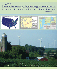
Digital Quest, Inc.s new book, A Geospatial Industry Series in Science, Technology, Engineering, & Mathematics, was written by in-house authors along with contributions from three experts networked on Twitter.
We know GIS, being that weve written several books on the subject, said Digital Quest president and founder, Eddie Hanebuth. But rather than simply explain how we want GIS to be, we desired to explain how it actually is. Twittering let us accomplish that by identifying expert contributors and thats exciting!
Digital Quests primary focus is supplying educational institutions with turn-key courses in skill training for students in the new and increasingly vital field of geospatial technology.
Digital Quests new classroom-delivered course is designed to show STEM skills through Green and Sustainability disciplines. Students answer questions using ESRI's ArcGIS Desktop software on topics including:
What alternative energies are abundant in my area?
Can we preserve green space in our community?
Where can a biodiesel fuel company strike oil?
How can geospatial technology be beneficial to conservation biology?
What is the biomass potential of a forest?
Which watershed will receive funding?
Where do we create, restore, enhance, or preserve a wetland?
How do carbon emissions change over time?
Five of the books ten lessons were written with assistance from three Twitter-connected experts.
Marc Seelinger, a wetland scientist and proprietor of the Swamp School (Twitter name: SwampSchool), contributed to lesson six on conservation biology, lesson eight on watershed management, and lesson nine on wetland mitigation.
Marcs expertise in these fields truly enhanced our own understanding of these important environmental issues. With all of our books, we want to show a scenario that mimics real world activities. Marc was integral in helping the team understand regulation and process for real world lessons. The idea of GIS lessons that are true to industry requirements is very exciting, said Austin Smith, Digital Quest's Vice President of Development and Support.
Jason San Souci, (Twitter name: JasonAFE) a remote sensing scientist and owner of AFE Advisor who works as a spectral analyst for Decisive Analytics Corporation, took time out of his schedule to assist the creative staff at Digital Quest in implementing one of his projects in lesson seven on biomass potential, added Smith.
Finally, Don Meltz, principal planner and owner of Don Meltz Planning and GIS (Twitter name: DonMeltz) graciously shared not only his planning expertise, but also data files for a real world case study that made lesson four on green space possible, Smith said.
A fourth contributor was Kevin Gurney, associate professor at Purdue University, Lead on Project Vulcan. Gurney runs a program that provides hourly carbon emission data broken down in to sub sector. Digital Quest hopes that the inclusion of data from this project can show the world one of the great resources that has been built to help make better decisions about our world.
The staff of Digital Quest decided to write the current book, aGIS in Science, Technology, Engineering, & Mathematics: Green & Sustainability Focus, due to national trends revealing the desire to better educate American students in the STEM fields.
How do we get more students involved in science, technology, engineering, and mathematics? asked Scott Weller, the companys director of national sales and marketing. We feel that students who see the growing relationships between skills in GIS and these four vital academic areas will be further motivated and energized to study or specialize in one of those fields.
This is the third book in a series based on the 16 Career Clusters, created by State Career Clusters Initiative, to show how GIS can be applied and used in these career clusters. The series is called aGIS, or a Geospatial Industry Series.
Digital Quests other major book series include:
SPACE, or Spatial Projects And Community Exchange, which shows students how to apply geospatial projects to their own, local community. SPACE is taken in a conventional classroom, the workplace, or at home.
STARS, or Spatial Technology And Remote Sensing, which is both a curriculum series and the leading national, industry-backed, entry-level certification program for students seeking to enter a GIS-related career, as developed in cooperation with the US Department of Labor Office of Apprenticeship. STARS is taken by students in colleges, community colleges, or technical schools. More than 300 students have completed STARS certification to date.
Digital Quest is Mississippi-based and operates out of MsETs the Center of Excellence in Geospatial Technology at NASAs John C. Stennis Center. The company is a member of the SkillsUSA National Geospatial Competition technical committee, and it also founded the Spatial Technology and Remote Sensing Geospatial Apprenticeship Program (STARS GeoAP), which offers a standardized way for schools, individuals, and employers to train skilled workers for geospatial jobs.
To learn more about the new book, GIS in STEM, find it on amazon.com or call 1-877- 5REMOTE (1-877-573-6683) , email salesusers@digitalquest.com, or visit www.digitalquest.com. President of Digital Quest, Eddie Hanebuth, twitters as GISGuy.
Back to Top
"Digital Quest Expanding Operations and Growing Sales Team"
Ridgeland, MS - Digital Quest, a Mississippi-based development and training company, is pleased to announce that they are expanding operations to keep up with the growing demand in the educational and training geospatial market. Austin Smith, employed with Digital Quest for the past four years, is being promoted to Vice President for Support and Development. He will be opening the newest branch office of Digital Quest in Chapel Hill, North Carolina, where he will oversee the support and development of new materials.
We have three major projects on our list including updating all of our current books, adding e-commerce to our web site and releasing a brand new certification testing instrument, said Austin Smith. I plan on being very busy.
In addition, Digital Quest is announcing Scott Weller as the new head of the national sales and marketing team. Scott has worked in marketing for the geospatial industry for seven years and as an educational consultant for the past ten years. He has instituted geospatial curriculum at all levels from kindergarten through post secondary. Scott helped Digital Quest create the blue print for the educational "Geospatial Hub Sites" and he will now help the Digital Quest sales team implement that plan nationally.
Digital Quest has a proven model that will help everyone be more successful, said Scott Weller. "I am excited to get to work with the Digital Quest team and all the sales representatives from around the country to implement Digital Quest solutions.
Digital Quest focuses on designing, developing, distributing, and supporting geospatial/remote sensing educational, classroom-based products including:
STARS: A series of courses that prepare students to take the GIS certification test. STARS is the first and only competency based, industry recognized, entry-level, geospatial certification.
SPACE: A series of courses, developed by the SPACESTARS partnership, designed to allow students to use GIS skills in the context of selected community based topics.
AGIS Book Series: A Geospatial Industry Series that examines an entire industry/ career cluster to show how geospatial technology impacts and improves those industries. These courses feature detailed narratives about the relationship between the particular industry and geospatial technology. In addition, guided lessons and scenarios give students hands on experience with GIS Software.
Having the caliber of personnel like Austin and Scott is key to Digital Quests future, stated Eddie Hanebuth, Founder of Digital Quest, Inc. These two have the skills, visions, and ability to drive Digital Quest to a whole new level.
Digital Quest, Inc. is a Mississippi-based development and training oriented company with a primary focus of enabling educational institutions to provide skill training in the new and ever-more vital field of Geospatial Technology. Digital Quest, an active member of the EIGS geospatial technology cluster, is headquartered in Ridgeland, Mississippi and operates the SPACESTARS Geospatial Training Laboratory at NASAs Stennis Space Center. For more information about Digital Quest, visit www.digitalquest.com or contact Scotty Weller at 1-877-573-6683, scottw@digitalquest.com.
Back to Top
3rd Annual Geospatial Competition to Showcase Best Geospatial Students in the Nation"
Ridgeland, MS Digital Quest, Inc. and SkillsUSA are pleased to announce the 3rd Annual Geospatial Technology Competition. This contest was created to provide post secondary students an opportunity to showcase their skills on a national level and compete for the SkillsUSA title of best in the U.S. for geospatial technology. The competition is being held in Kansas City, Missouri, June 23-June 27, 2008.
Registrations for the contest are currently being accepted at www.digitalquest.com/SkillsUSA08. The first 50 students that are verified as post secondary students registered in programs that teach GIS will receive invitations to participate in the contest. The qualified student contestants will receive the STARS certification kits, worth $500 including a 60-day evaluation license of ESRI ArcView 9.2 software. They will receive a formal invitation to the contest and a password to a protected ftp site. Students will then download the 2008 STARS Geospatial Project and will need to prepare and complete this project in advance of the competition in Kansas City in June.
In Kansas City, the contestants will orally defend their GIS project, as well as take a written technical knowledge test and a hands-on test of geospatial technology skills. Those college contestants at the Kansas City competition whose aggregate score reaches at least 75 percentile will be awarded STARS Certification. STARS (Spatial Technology and Remote Sensing) is a fully developed turn-key certification program for high schools, colleges and universities as well as career professionals looking to integrate geospatial tools into their on-the-job skill set.
The top prize includes a complete software package of ArcGIS ArcView and four extensions student software package worth $10,000 from ESRI, and a $1,000 cash scholarship to reimburse travel expenses to Kansas City. Other prizes include the ArcGIS ArcView student software package, and $500 and $250 scholarships for 2nd & 3rd place winners.
###
Digital Quest, Inc. is a Mississippi-based development and training oriented company with a primary focus of enabling educational institutions to provide skill training in the new and ever-more vital field of Geospatial Technology. Digital Quest, an active member of the EIGS geospatial technology cluster, is headquartered in Ridgeland, Mississippi and operates the SPACESTARS Geospatial Training Laboratory at NASAs Stennis Space Center. For more information about Digital Quest, visit www.digitalquest.com or contact Eddie Hanebuth at 1-877-573-6683, eddieh@digitalquest.com.
SkillsUSA is a partnership of students, teachers and industry working together to ensure America has a skilled work force. . The national organization helps all students excel in their training programs and future technical, skilled and service careers. SkillsUSA serves more than 285,000 students and instructors annually. The organization has 13,000 school chapters in 54 state and territorial associations. More than 14,500 instructors and administrators are professional members of SkillsUSA. For more information, visit www.skillsusa.org.
Back to Top
More Press for Joppatown High School's Homeland Security:
"How to Stop Terrorism? Begin in School"
by Sibile Morency, ABC News
January 11, 2008
January 2008 -- Homeland security is one of the hottest issues in this year's presidential election, the candidates sparring daily over who is best qualified to protect the nation against terrorist threats.
Meanwhile, Leah Beaulieu is busy educating the next generation of security experts. Beaulieu teaches the nation's first homeland security high school program at Joppatowne High School in Joppa, Md.
Sixty-one Joppatowne 10th-graders enrolled this year to spend three years learning about protecting the country against terrorism.
The sophomores choose specific areas of homeland security that they would like to explore during their junior years. And as seniors, they complete internships or shadow homeland-security professionals on the job.
"We introduce our students to all major areas of homeland security. We start off with a historical perspective, learning where terrorism comes from, the political motivations, even going back to the Crusades and talking about change over time," said Beaulieu.
The program, which has been lauded by some in law enforcement, educates them on cutting-edge security technology, law enforcement and criminal justice, and teaches them to identify potential chemical and biological threats. Its creators say it will prepare the young students to enter a growing industry that could one day employ thousands of new workers.
But the program has also raised concerns about the appropriateness of teaching such a serious, politically charged subject matter to high school students.
Education or Indoctrination?
David Volrath, director of secondary education for Maryland's Hartford County public schools, insists that the school's main motivation is to help students find future jobs. There are high-tech companies in the area, and the Defense Department's Aberdeen Proving Ground is nearby.
"When we recognized that these industries were coming to support research at Aberdeen, we realized the opportunity for our students," he said.
And Jack Cloonan, a former FBI agent and president of Clayton Consultants Inc., a global risk crisis management firm, praises the high school for being the first in the nation to take this initiative.
"Those of us in this type of business often get criticized for running around, screaming the sky is falling, [but] we do have to keep the public vigilant," he said. "This is a very important educational message. If it's first introduced at the high school level, along the line it will increase people's professionalism."
But other observers warn that the the educational message must remain distinct from any political implications.
Jonathan Zimmerman, director of New York University's History of Education Program, encourages the inclusion of homeland security issues in the school's curriculum, but he urges the school to make sure it focuses on teaching national security.
"The devil is in the details. Is the school educating or indoctrinating? The job of public schools is not to get people to vote for or against Bush. [Rather] it's to teach kids the tools to evaluate Bush," he says.
Read Full text of Article here
Back to Top
"[Joppatown High School's] homeland security studies get noticed"
by Mimi Hall, USA Today
December 10, 2007
December 2007 -- The nation's first comprehensive high school homeland security program, a three-year course to help kids land jobs in the growing anti-terrorism industry, is in its infancy in Maryland. But it's recently been attracting the attention of educators and school districts from as far away as California and Florida.
The program, started at Maryland's Joppatowne High School with 61 sophomores, provides "an opportunity for kids to see relevance to being in school," says Frank Mezzanotte of the Harford (Md.) County Public Schools. "It gives kids additional options."
Students have toured a Coast Guard command center, visited a county detection center, practiced emergency response in a fictional town called "Joppaville" and heard an Iraqi-born speaker explain cultural differences between Americans and Middle Easterners.
"We're trying to set high expectations," says student Megan Bell, 15. "We don't want to be known as just the school with the good football team. Now we have homeland security."
Other school districts are taking notice. Mezzanotte says he's been contacted by individual schools and education departments in more than a half-dozen states.
"Joppatowne broke the ground for all of us," says Lise Foran of Anne Arundel County Public Schools in Maryland. Next fall, Meade High School will begin a Homeland Security program. "We're following in Joppatowne's footsteps."
And on Wednesday, Mezzanotte will be in Las Vegas, where he has been asked to give a presentation on the program to the Association for Career and Technical Education annual conference.
Some question whether the program will teach students to be open-minded about the government's national security policies, given its goal of getting kids jobs with defense and homeland security contractors and the military. The liberal magazine Mother Jones dubbed Joppatowne "the academy of military-industrial-complex studies."
Jonathan Zimmerman, a New York University history of education professor, says "the devil lies in whether this is going to be a school for education or indoctrination."
Other educators applaud the school for taking steps to prepare kids for one of the nation's expanding job markets and for connecting what they learn in school to what's happening in the real world.
"This sounds to me like it has all the earmarks of what keeps young people in school," says former West Virginia governor Bob Wise, now head of the Alliance for Excellent Education. "It gives them the skills necessary for the modern workplace."
Read Full text of Article here
Back to Top
Digital Quest Develops Geospatial Industry Book Series
October 2007 -- Ridgeland, MS, -- Digital Quest is pleased to announce the development of a new series of course books that examine 16 industry/career clusters to demonstrate how GIS technology impacts and improves those industries. A Geospatial Industry Series (AGIS) will examine the relationship between the particular industry and GIS. In addition, guided lessons and scenarios will give students hands-on experience with a variety of applications of GIS using ESRIs ArcGIS Software.
The career clusters are based on the 16 Career Clusters developed by the NCTEF/NASDCTEC (National Association of State Directors of Career Technical Education Consortium) as a means to provide a link between "what students learn in school with the knowledge and skills they need for success in college and careers." (Career Clusters Institute, www.careerclusters.org) The link between education and careers makes this program ideal for students and professionals alike. Since the career clusters encompass all industries that are pertinent to a specific cluster, students can learn what they need to know to begin a career in a variety of industries. Professionals will also find this book useful in defining the best ways GIS can be used in their organization.
The first release in the new series, AGIS Introduction to Geospatial Technology, includes ten lessons designed to demonstrate key concepts, software capabilities, and future opportunities in the geospatial industry. The lessons contain overviews of career profiles including examples of industries and individuals that use this technology. Students will gain hands-on experience using industry-leading ESRI's ArcGIS software in eight lessons that explore agriculture, business, information technology, logistics, public safety, health science, tourism, and technology engineering.
Educators will find the modular design of the course easy to implement in their classroom. Colleges will be able to use this book to supplement existing courses such as: "Introduction to Computers"; "Integrating Science and Technology"; Environmental Education"; "Tools in Business"; and many others. High Schools can integrate this course into classes including: "Project Lead the Way"; "Career Exploration"; "CAD"; and "Technology Education". They series is a perfect fit for any STEM based indicatives with the total time to team this class from 6 to 18 hours. For more information on ordering the Book Series, please visit www.digitalquest.com or call 877-573-6683 x. 225.
"Look for our second book in the series AGIS in Agriculture to be released later this year," stated Eddie Hanebuth, President of Digital Quest Inc. This book will focus on the Agriculture, Food, and Natural Resources industry cluster area and will examine the industries involved from animal and plant systems to power infrastructure to resource and agribusiness management.
Digital Quest, Inc. is a Mississippi-based development and training oriented company with a primary focus of enabling educational institutions to provide skill training in the new and ever-more vital field of Geospatial Technology. Through our partnerships and associations with organizations such as SPACESTARS, Environmental Systems Research Institute, (ESRI), Enterprise for Innovative Geospatial Solutions (EIGS), Mississippi Enterprise for Technology (MsET), NASA, SkillsUSA and others, Digital Quest is able to deliver complete turn-key courses which can be taught by instructors with little or no previous GIS knowledge, and which can provide entry-level GIS technician certification to its students. Digital Quest runs the STARS Geo Apprenticeship Program through the U.S. Department of Labor, the SkillsUSA National Geospatial competition, and the SPACESTARS teacher training Laboratory at the Center of Geospatial Center of Excellence in NASA's John C. Stennis Space Center.
Back to Top
Digital Quest's STARS Approved by Maryland for Homeland Security Ed. Program
September 2007 -- Ridgeland, MS, -- Digital Quest, Inc. is pleased to announce the adoption
of its GIS in Homeland Security Course and its flagship product, the STARS
Certification, by Harford County Public Schools for their Career and
Technology Education Pathway Program for Homeland Security and Emergency
Preparedness. This program, housed at Joppatowne High School, is the first
of its kind in the nation. It is dedicated to providing students with
career skills and technological expertise in the areas of Homeland Security
and Emergency Preparedness (HSEP).
The HSEP program provides a foundation-level course followed by advance
options that include courses designed to advance student knowledge and
skills and lead to industry certification and/or college credit. The
Information/Communications Technology option prepares students for
certification in the use of Geographic Information Systems (GIS) as it is
used in relation to Homeland Security. Students will generate geospatial
maps and emergency response plans specific to their community.
"One of the reasons the Maryland State Department of Education fast tracked
this program for distribution throughout the state was our partnership with
Digital Quest," said Eric Cromwell, Coordinator of Accelerated Learning
Programs for Harford County Public Schools. "We are eager to implement the
GIS in Homeland Security curriculum and the Geospatial Technologies
Certification Program."
STARS (Spatial Technology and Remote Sensing) is a fully developed
"turn-key" certification program for high schools, colleges and university
as well as career professionals looking to integrate geospatial tools into
their on-on-the job skill set. STARS is the first industry-recognized
geospatial certification recognized by NASA, the U.S. Department of Labor,
and by industry leaders.
"Working with the Digital Quest team was an extraordinary experience, said
Cromwell. "For example, when we returned from training at the National
SPACETARS training Lab at NASA's John C Stennis Space Center, we requested a
few changes be made to better fit with our specific curriculum. Digital
Quest quickly modified their GIS in Homeland Security course to fit our
curriculum needs. It is wonderful to work with a group willing to go the
extra mile to help our schools be successful!"
The STARS courses for the HSEP program will introduce students to GIS and
Remote Sensing technology through academic study and applied instruction and
will offer a series of half-credit courses including:
* Introduction to Geographic Information Systems and Remote Sensing
* Skill-Based Training for Geographic Information Systems and Remote
Sensing
* Advanced Skill-Based Training for Geographic Information Systems,
GPS, and Remote Sensing
* Geospatial Application Project with a Final Certification Exam
"We are excited to have the combination of our GIS in Homeland Security
course and the STARS Entry-Level GIS Technician Certification provide the
foundation for the Information/Communications Technology option for this
innovative program," said Eddie Hanebuth of Digital Quest.
Back to Top
Digital Quest and SkillsUSA Announce 2007 Geospatial Technology Champion
August 2007 -- Ridgeland, MS, -- Digital Quest, Inc. and SkillsUSA are pleased to
announce the gold medalist in the Postsecondary Geospatial Technology
Challenge at the SkillsUSA National Leadership and Skills Conference and
Competition that was held in Kansas City, Missouri on June 26, 2007
June Garneau of Berlin, New Hampshire won first place and is the recipient
of thousands of dollars in ArcGIS software and a cash award both donated by
ESRI of Redland, California. Garneau's gold medal was based upon an
extensive pre-challenge project, STARS testing, and completion of challenge
events at the conference. Garneau is a 2007 graduate of the one-year
Spatial Information Technology/Geographic Information Systems (GIS)
certificate program at New Hampshire Community Technical College in Berlin.
"My interest began one year prior to the competition, when I enrolled in a
GIS course for kindergarten through 12th grade teachers," said Garneau. "I
was so interested after the course that I decided to pursue the field of
GIS. I am so pleased to end my year of study with this competition and the
gold medal."
This is the second year Skills USA has offered national college competitions
which were designed to provide colleges with an effective way to validate
their technical programs and measure them against national standards. The
Geospatial Technology Challenge was initiated in February 2007 with an
on-line, 150 question qualification exam that tested academic knowledge,
technical knowledge within the subject area, and general employability
skills. Qualifying contestants were required to complete a STARS
certification project.
Garneau's project involved Global Positioning Systems (GPS) data collection,
surface model development, and site analysis based upon pre-set competition
criteria. June chose White Mountain Regional High School as her project,
which focused on the best location for a garden. According to Garneau, she
put at least 80 hours into her project, which included choosing a location
in which to use digitizing techniques and GPS data collecting to create a
campus based model including building, water sources, sport facilities, and
other campus features. From her base model, she created 3-dimensional models
and a preferred garden location based upon six preset criteria. As part of
the competition, she had to prepare a PowerPoint presentation, maps, and a
written report.
"The experience gave me a unique opportunity to expand my knowledge, build
my confidence and abilities in GIS, and to successfully meet challenges that
took me through a whole range of skill sets," says Garneau.
As part of the prize package, Garneau earned the STARS Certification from
Digital Quest, Inc. STARS (Spatial Technology and Remote Sensing) is a
fully developed "turn-key" certification program for high schools, colleges
and university as well as career professionals looking to integrate
geospatial tools into their on-on-the job skill set. STARS is the first
industry-recognized geospatial certification recognized by NASA, the U.S.
Department of Labor, and by industry leaders.
More than 5,000 students from high school and colleges throughout the U.S.
competed in the 43rd Annual SkillsUSA Championships in 87 different
contests. High school and college students may download the free 2007
SkillsUSA Competition hands-on examination in preparation for the 2008
examination from www.esri.com/arclessons.
###
Digital Quest, Inc. is a Mississippi-based development and training oriented
company with a primary focus of enabling educational institutions to provide
skill training in the new and ever-more vital field of Geospatial
Technology. Digital Quest, an active member of the EIGS geospatial
technology cluster, is headquartered in Ridgeland, Mississippi and operates
the SPACESTARS Geospatial Training Laboratory at NASA's Stennis Space
Center. For more information about Digital Quest, visit
www.digitalquest.com
SkillsUSA is a partnership of students, teachers and industry working
together to ensure America has a skilled work force. . The national
organization helps all students excel in their training programs and future
technical, skilled and service careers. SkillsUSA serves more than 285,000
students and instructors annually. The organization has 13,000 school
chapters in 54 state and territorial associations. More than 14,500
instructors and administrators are professional members of SkillsUSA. For
more information, visit www.skillsusa.org
Digital Quest's STARS Certification Selected for Department of Labor's
National Standards of Apprenticeship for Geospatial Technician
Back to Top
Digital Quest's STARS Certification Selected for DoL National Standards of Apprenticeship
July 2007 --Ridgeland, MS -- Digital Quest, Inc. is pleased to announce that the
national Spatial Technology And Remote Sensing Geospatial Apprenticeship
Program (STARS Geo AP) has adopted the STARS certification curriculum
materials as part of the National Standards of Apprenticeship developed in
cooperation with the U.S. Department of Labor's Office of Apprenticeship for
the occupation of Geospatial Technician.
The Spatial Technology And Remote Sensing Geospatial Apprenticeship Program
(STARS Geo AP) was established to increase the level of skilled workers in
the Geospatial Industry based on national industry-backed standards. The
program provides a standardized way for schools, individuals, and employers
to train skilled workers for geospatial jobs. The combination of on-the-job
learning (OJL) and the successful completion of the STARS certification
materials will result in well-rounded, competent Geospatial Technicians for
the geospatial field, one of the fastest growing career fields in the U.S.
"We recognized that the responsibility for training rests with those in
industry who are the benefactors of a skilled workforce," stated Eddie
Hanebuth of Digital Quest, Inc. "In order to maintain the high level of
competence demanded by the geospatial industry, the STARS Geo AP Executive
Board was made up of industry leaders and employers who were critical in
formulating and adopting the National Apprenticeship Standards for the
training of apprentices in this industry."
STARS (Spatial technology and remote sensing) is a fully developed
"turn-key" Certification program for high schools, colleges, and
universities as well as career professionals looking to integrate geospatial
tools into their on-on-the job skill set. STARS certification, offered by
DigitalQuest, Inc., is supported by the companies in the Center of
Geospatial Excellence located at NASA's John C. Stennis Space Center. STARS
is an output driven, competency-based program in which students master the
use of geospatial problem solving, software, data, and tools standard in the
geospatial industry.
The suggested work activities and the correlating STARS coursework are
designed to allow for individualized training and work assignments. The
company and customer needs determine the key deliverables required of the
apprentice. The core requirements include a term of twelve to twenty-four
months with a minimum of 1,000 documented OJL hours as well as the STARS
certification coursework. This combination of on-the-job learning and
geospatial studies allows for multiple exit and entry points based on the
individual apprentice and the organizations' needs.
"We believe that the most practical, well established, and sound method of
preparing geospatial employees is through registered apprenticeship
programs," said Craig Harvey, CIO of NVision Solutions and a member of the
STARS Geo AP Executive Board. "An apprenticeship program allows for
training under actual job conditions supervised by experienced geospatial
workers. Using the STARS certification along with this on-the-job training
will create both a knowledgeable and experienced geospatial worker. This is
a strategy that will greatly benefit both the employee and the employer."
Back to Top
Digital Quest featured in "Pointe Innovation" magazine's article: "No Boundaries: Geospatial Training Moving Full Throttle in Mississippi"
by Lynne Jeter, Pointe Innovation Magazine
March 2007 -- Digital Quest, a Ridgeland-based private development and training-oriented company, and the Institute for Advanced Education in Geospatial Sciences (IAEGS) at The University of Mississippi also offer innovative GIS training opportunities
in the state.
The Mississippi geospatial community is playing a direct leadership role in the advancement of geospatial technology throughout the U.S., noted Eddie Hanebuth, president of Digital Quest.
Growing the geospatial industry dovetails nicely with the states goal to grow more higher-paying, high technology jobs. According to the Enterprise for Innovative Geospatial Solutions, the average annual salary for geospatial jobs in Mississippi is $55,000. In the last decade, Mississippis geospatial industry has grown from a dozen to nearly 700 jobs. Geospatial revenues have jumped from $15.8 million in 2001 to $75 million in 2006. Last year, state income tax generated from the geospatial industry was $1.4 million; more than $50 million has been invested in Mississippi geospatial companies. Cash investment in Mississippis geospatial cluster activity from 1998 to 2006: $208 million.
Pointe Innovation Magazine, Lynne Jeter, Spring 2007. Read Full text of Article here
Back to Top
Follow Us On:
 |
Share With Others:
|
Share With Others:


